Find data. Combine it. Map it. Explore it. Export what you build and share it with others. With GEO.ca find the data you need and use it in the way that works for you. Our step-by-step instructions below will help you get started.
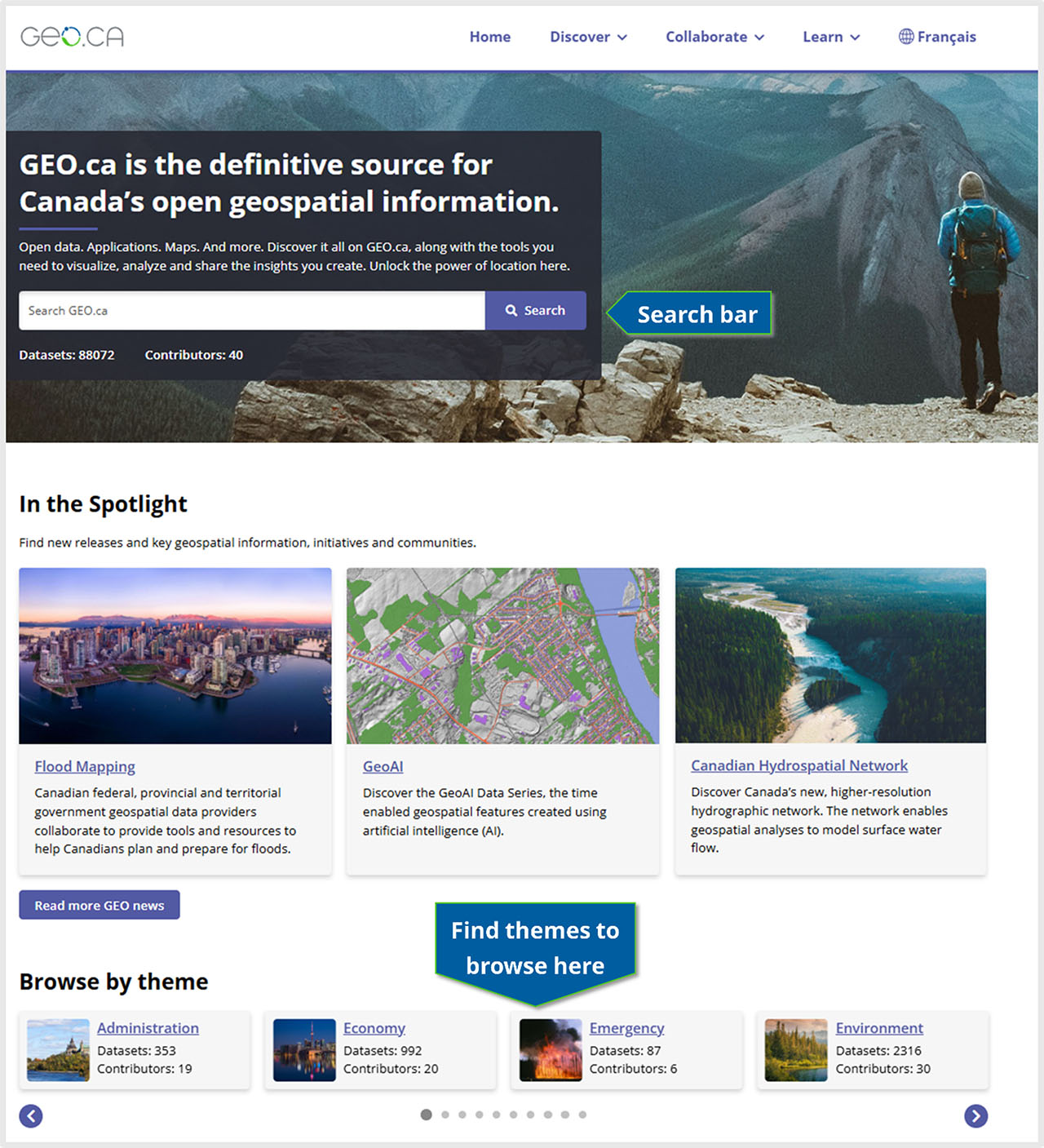
Use the search bar: Use the search bar to search the entire collection of federal, provincial and territorial location-based data.
Browse by theme: Explore one of our nine themes to search for data and view featured maps, applications and datasets.
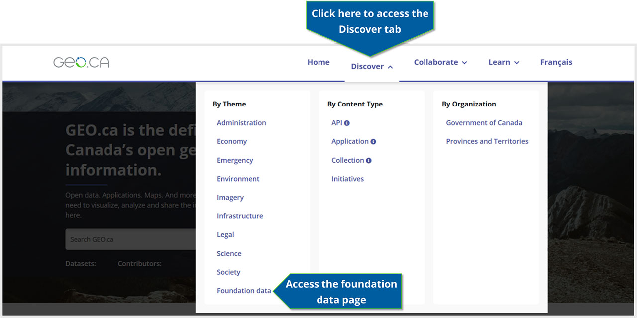
Use the Discover tab
Search by themes, content type or organization: In addition to the themes, you can search by content type, like APIs, or the publishing organization.
Get foundation data: Find the base data that describes Canada’s water, land and built infrastructure – the geographic foundations essential to underpin and contextualize thematic data.
Advanced search
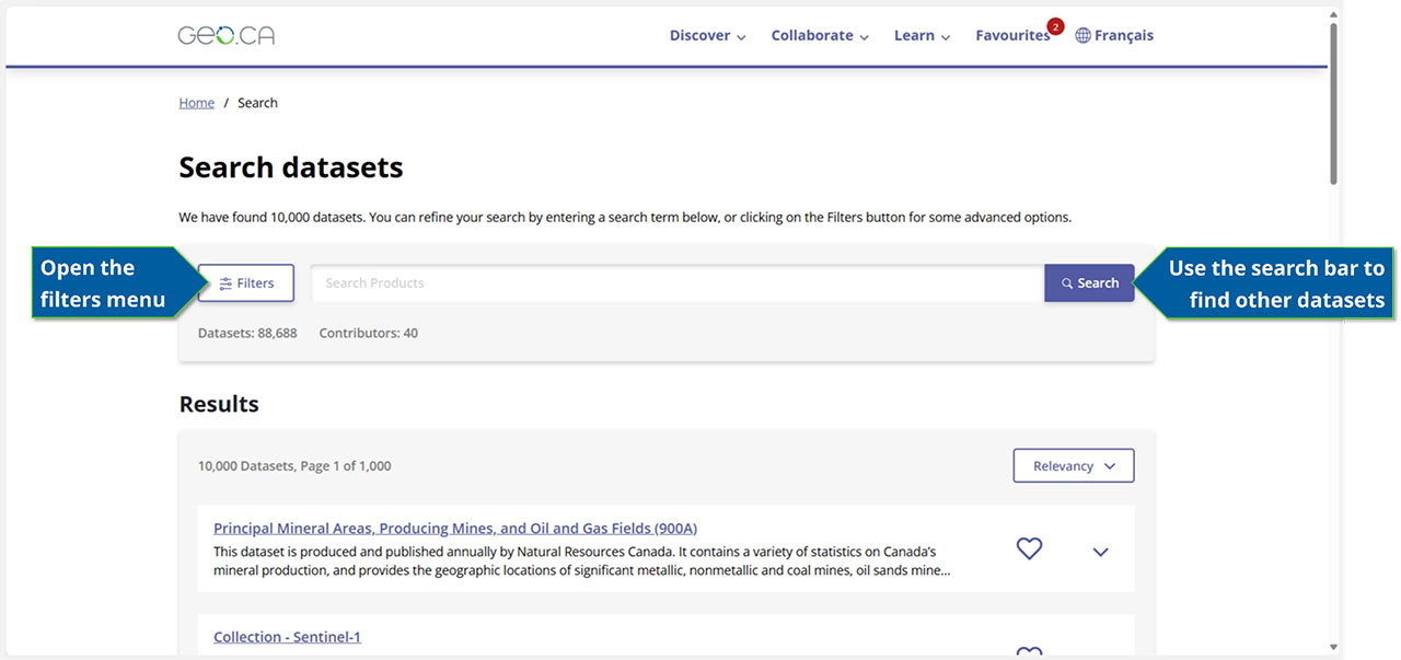
Using the search bar from the homepage will bring you to the advanced search page where results are listed and you can make new searches.
Search bar: Use keywords, dataset titles or unique IDs in the search bar.
Filters submenu: Select an advanced filter to refine search results based on categories, organizations, types, spatial or temporal extent and more. Add or remove filters to achieve the results you need.
Get data
View results
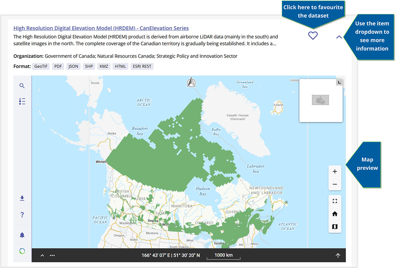
Item dropdown: Click on the dropdown to preview the result. The preview includes the dataset title, description, publishing organization, available data resource formats and a map preview if available.
Favourite: Click the heart icon to favourite the dataset and save it for later so you can keep searching.
Map preview: An interactive map is available for each result; this can be a preview of the data or index of files if available. If the dataset is not enabled for map viewing it will show the geographic extent of the dataset.
View record
Access the full dataset record by selecting the title of the result.
Access the data
On the dataset’s record page, you have access to a map of the data, if available, and a list of all data resources for the dataset. Selecting these resources will download or open the given resource in the format described.
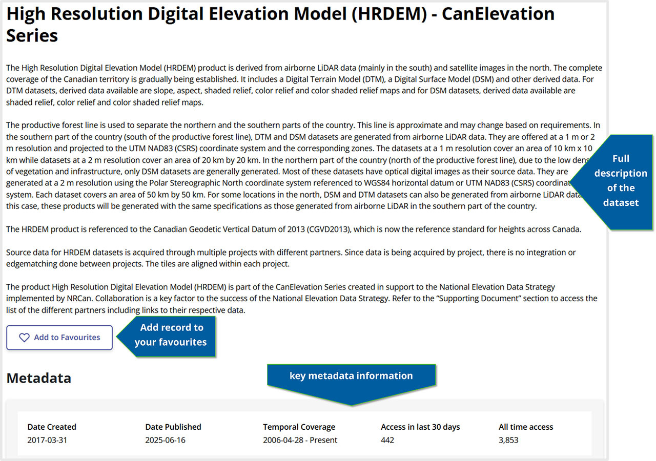
Description and metadata: The record starts with the high-level description of the dataset. Then you can favourite it and find key metadata information like the publishing organization and licensing.
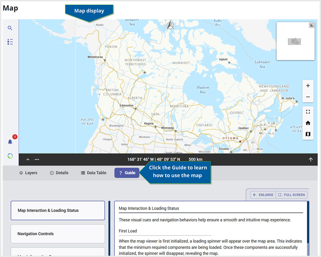
View the map: Explore the data or its index, if available, in the GEO.ca map viewer, GeoView.
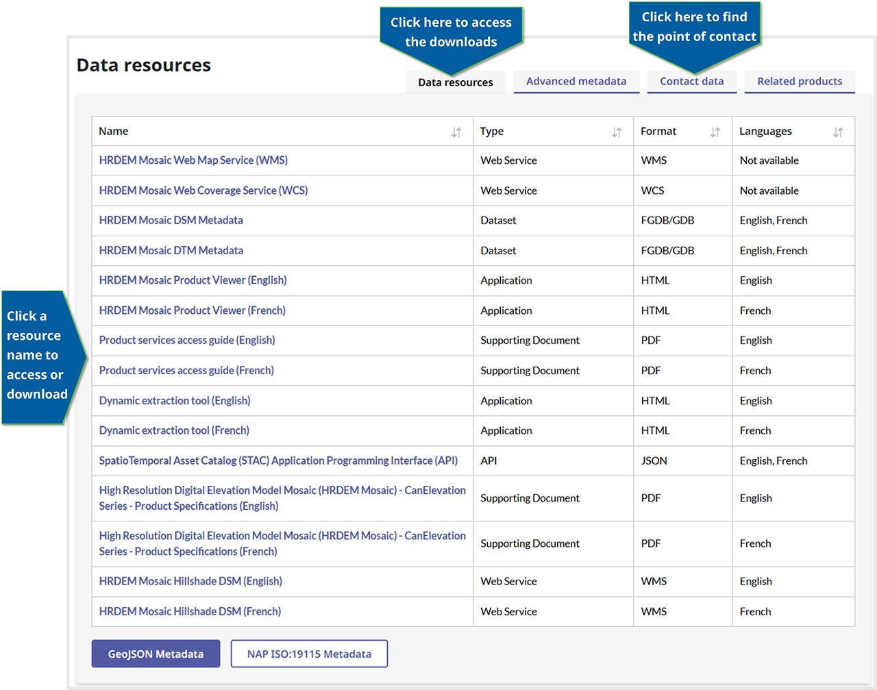
Access the data: Under the map, the data resources table provides the links to download or access the data, supporting documentation or web services. Select other tabs at the top of the table to find more information including advanced metadata, the contact information for the publishing organization, and related products.
View similar records
Is this not the data you are looking for? At the bottom of the dataset record page is a list of suggestions for similar records.
Create a map
Follow these simple steps to select and combine content and create your own map to analyze and share:
View your map
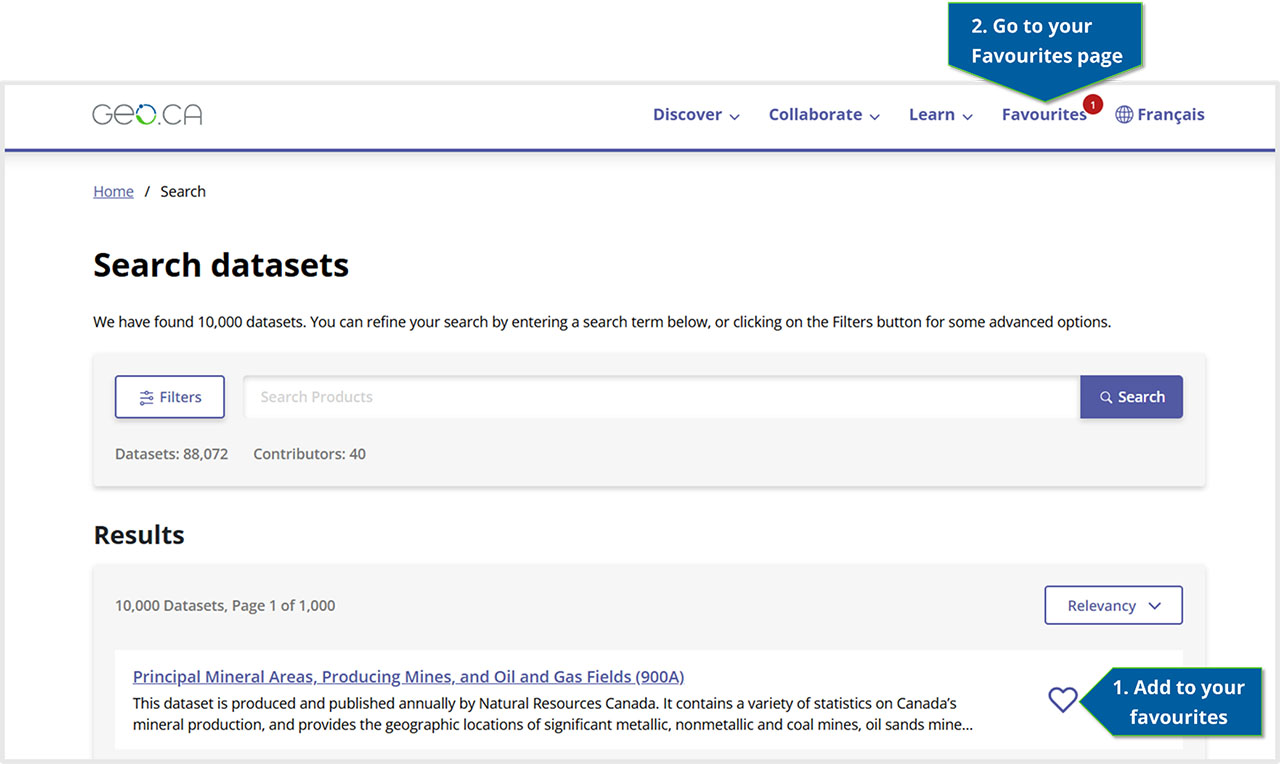
Datasets in your search results can be added to your favourites by clicking on the heart-shaped icon next to an item in the search results
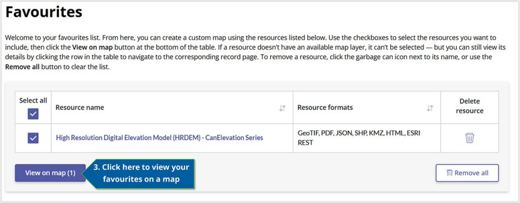
Once you have your datasets, go to your favourites page from the top navigation menu
On the Favourites page, click “View on map” under the table to access an interactive map displaying all your favourites that are enabled for viewing
Upload your own data
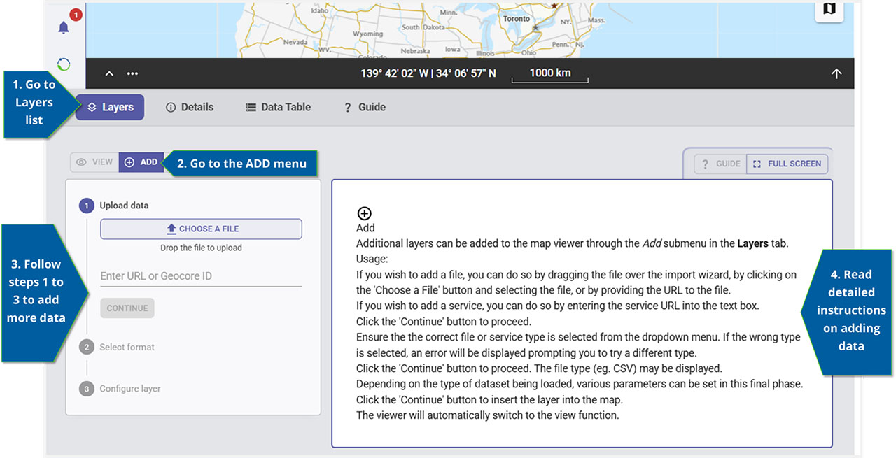
Add more data to your map! To add data from other sources you can import it by using the “Add” submenu under the layers tab. Data or services can be added by uploading a file, entering a web service URL or adding more GEO.ca datasets using the unique ID.
What is the unique ID?
Every dataset record has its own unique identifier in the last segment of the URL path. For example, the unique ID for the High Resolution Digital Elevation Model Mosaic is 0fe65119-e96e-4a57-8bfe-9d9245fba06b.
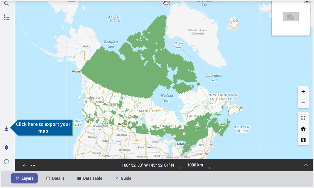
Export your map
To export your map, use the “Export” function in the sidebar to the left of the map display. This will allow you to download your map.